The Weather at Howhill
Events - 30 July 2002
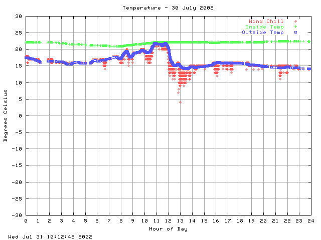
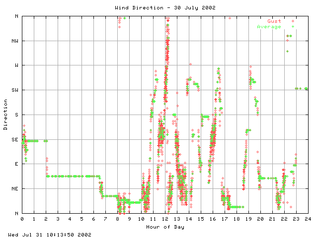
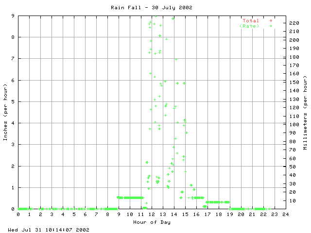
The first thunderstorm passed to the north on a SW to NE track at midday. It was moderately active, produced a fair amount of heavy rain and lasted 10 to 15 mins. I was outside painting some window frames (silly boy!) and there were some really noticeable changes to the air. At about 1100 it was still, hot (22°C), sticky and mildly unpleasant. Then it became much more pleasant although there wasn't much of a temp change and the air started to move a little. Watching the rain approach across the valley the wind outflow arrived about 10 mins before the rain, going from F2 to F5 in minutes. The temperature dropped considerably from the 22°C to 15°C.
The second passed overhead or slightly to the south, but on a more S to N track. Very active, strikes every two seconds or so and torrential rain for about 30 mins.
The third was less active but still produced a hefty amount of rain.
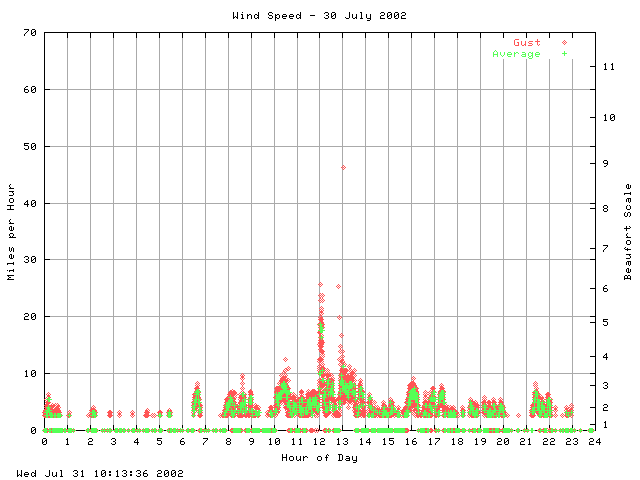
The first two storms show clearly on the wind speed graph an hour apart. The third less so and was far less defined than the previous two. There was constant rain and rumbling thunder right up to 1700.
The rain gauge is broken, which is a great pity as we must have had a good 60mm or more of rain from these storms. There was lots of local flooding of the roads and the burns and gills which that morning where just dribbles after a hot dry spell turned into raging torrents. Take a look at these photographs.
| Howhill Weather - Events |

 This page is standards compliant |
Updated: Sat 26 Mar 2005, 01:14 GMT |